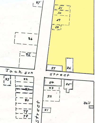
MISSING BUILDINGS (#29-31)
1860
 >
>
(George & Barbara Eastman Map - Dec. 1958)
Missing Buildings

Forgotten Buildings is what Mrs. George W. Eastman called her compilation as she described (in 1954) what was here: Main Street East

© Columbia State Historic Park.
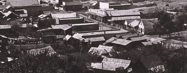
The cluster of buildings around the
Claverie Store(#28) looking south. - c1866
1852 November 22 - Edward Sweeny sold to Juan Questai a one-story frame building on the east side of Main Street (North of Jackson Street). That bulding became Questai's Fandango House (#29). Juan Questai is also the card index listing of his name. The building will later become a Chinese Joss House. - (G & B Eastman 1958)
1854 June 17 - Juan Questai with his wife Dahlia Escobar mortgage to Juan Dupont for $1563.56 four lots and property.
1855 January 10 - Juan Questai mortgaged to John Jolly for $300 his property on State Street, which included a one-story brick - second house from nortwest corner on Main & State Streets, on State. (E1:15:32H)
1859 September 12 - Questai and wife lost their two properties in a sheriff's sale. (E1:13:32A)
1859 September - After foreclosure, both of the buildings/properties are purchased by Jean Laurente from Giranin Questai. (E1:15:31)
1861 November - the building sells to Jean Baptiste Maitrejean, Joseph Maitrejean and Rene Maussaud. John Preston has a shoe business, sharing the building with Glazier and Loud.
1865-6 Property is assessed and mined. (E1:12:18C)
Richberger's Blacksmith Shop. (#30) The 28th of June 1860 census for Township 1 (Sonora, Tuolumne Co.) has a Henry Rishberger Age 48 born in Pennsylvania working as a S(aw) Mill Laborer. The 20th of July 1870 census for Township 9 (Copperopolos, Calaveras County) show a Henry Rishberger (German pronounciation?) Age 59 born in Pennsylvania working as a Blacksmithey. A card index in the Columbia museum shows a Harry Richenberger as a blacksmith on this location. No census on that name.
Bayhaut's Brick Grocery Store (#31) His name on the card index for this location is Dominique Bayhaut.

From a copy of the map of Columbia 1860 that was compiled by George W. & Barbara Eastman Map - Dec. 1958

This page is created for the benefit of the public by
Floyd D. P. Øydegaard.
Email contact:
fdpoyde3 (at) yahoo (dot) com
A WORK IN PROGRESS,
created for the visitors to the Columbia State Historic park.
© Columbia State Historic Park & Floyd D. P. Øydegaard.
 >
>

 >
>


